WWNO skyline header graphic
Play Live Radio
Next Up:
0:00
0:00
0:00 0:00
Available On Air Stations
Local Newscast
Hear the latest from the WWNO/WRKF Newsroom.

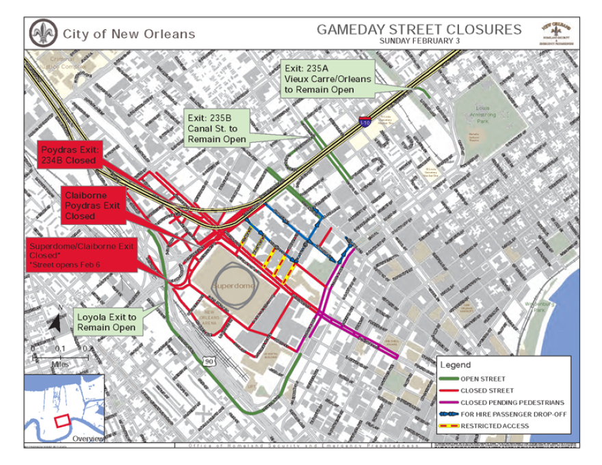
Super Bowl 2013 Traffic Maps

The City of New Orleans has released maps delineating road closures and other traffic restrictions before, during and after this year's Super Bowl, held Feb. 3 at the Superdome.

Find out more, including schedules and venue information, on the city's Super Bowl preparation website.

Updated Jan. 30

Credit New Orleans Police Department

Jason Saul served as WWNO's Director of Digital Services. In 2017 he took a position at BirdNote, in Seattle.

👋 Looks like you could use more news. Sign up for our newsletters.

* indicates required
New Orleans Public Radio News
New Orleans Public Radio Info